Netpower / References / Digital tool for accessibility mapping
Kartverket
Digital tool for accessibility mapping
Kartverket’s new digital tool brings geographic information together for better, more precise accessibility mapping.
Written by Oda Hjelmeland
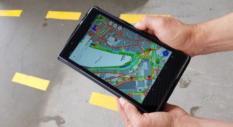
Photo by Kartverket.
Netpower has delivered:
Modernising data collection
Kartverket (the Norwegian Mapping Authority) holds national responsibility for maps, geodata and property information. That includes collecting, structuring and publishing geographic information that matters to public bodies and private business alike.
To improve the quality of its accessibility data, Kartverket has spent recent years modernising its field collection methods. The goal: simpler, more efficient and far more accurate recording out in the field. Netpower was chosen as the technology supplier for that work.
Easier data collection
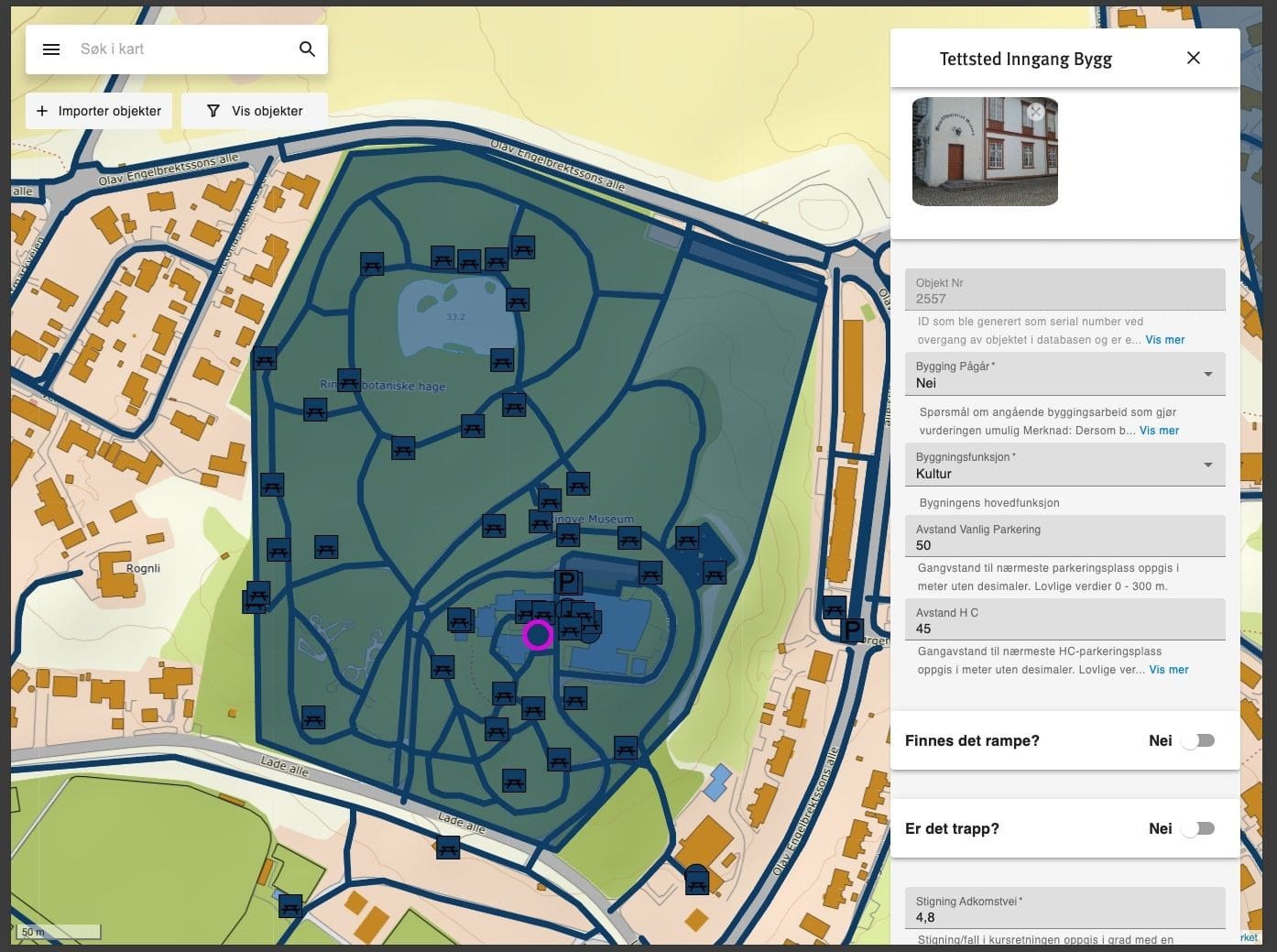
The new web application makes it easy to record objects and conditions out in the field.
That might be, for example:
- Walking trails and recreation areas
- Benches and tables
- Pedestrian crossings
- Entrances to public buildings
- Car parks
- Steps and wheelchair ramps
- Toilets

An intuitive field tool anyone can use
An important focus has been to build a system anyone can use, whatever their technical background. Summer temps at the local council, volunteers at the hiking association and professional consultants all have to be able to record data without extensive training.
The solution includes, among other things:
- Map-based recording: the user clicks directly on the map to add objects such as seating areas, outdoor toilets, parking spaces, steps or wheelchair ramps.
- Form-based reporting: once a location is chosen, a detailed form appears where the user fills in the relevant details – surface, heights, widths, audible signals, door types and gradients.
- Automatic assessments: the system calculates accessibility automatically against fixed criteria, and summarises the assessment for both manual and powered wheelchairs.
- Manual assessments: the user adds their own judgement of whether the object is accessible for wheelchair users and for blind visitors.
The app is built as a light, modern React application using Leaflet for maps, which gives fast performance and offline use through PWA technology. It also uses GeoID for simple, secure log-in. A technical upgrade of the app is currently under way.
Offline functionality
Much of the mapping work happens in woodland, in parks, along walking trails and generally in places where mobile coverage is patchy. Being able to record data without a network connection was therefore essential.
The web application uses Leaflet to display maps, which means the map is made up of small image tiles. These are stored locally as the user moves around, so the map keeps working with no connection. When a user records an object while offline, the data is stored locally on the device. As soon as the device is back online, the data is sent securely on to Kartverket’s systems.
Norway was an early mover in digitising geodata. There was no international standard at the time, so Norway developed its own format, SOSI. The solution handles SOSI data today, but is prepared for a future move to modern formats such as GeoJSON.
Complex logic behind the solution
The solution may be simple to use, but the logic behind it is extensive.
The web application weighs automatic parameters such as gradient, width, heights and surface against accessibility for wheelchair users and for blind and partially sighted people. Every rule for assessing universal design is built in, and many factors have to be balanced against each other to arrive at a correct assessment.
Then there are the challenges of digital maps themselves. Maps rely on different coordinate systems and map projections – ways of translating the curved surface of the earth onto a flat map. That translation always introduces some geometric distortion, of size, shape or distance. Different systems store position data in different ways.
Two standards are particularly relevant:
- Web Mercator – EPSG:3857 (WGS 84): used by most web mapping services, such as Google Maps and OpenStreetMap, and by frameworks such as Leaflet. The projection is fast and widely supported, but offers limited accuracy for measurements in Norway.
- EUREF89 UTM zone 33N – EPSG:25833: the projection Kartverket uses, optimised for Norwegian conditions. It gives considerably higher geographic precision.
Because Kartverket delivers data in EPSG:25833 while most display solutions use EPSG:3857, the application has to convert the coordinates so that objects appear in the right place on the map. All of that happens in the background, so the user gets a seamless and accurate map experience.
Greater efficiency, structure and automation
With the new web application, Netpower and Kartverket have achieved clear results:
- Efficient field recording for local authorities and organisations
- Structured data that other external parties can reuse
- Automatic assessments that produce better, more consistent records
Sven Michaelis, Senior Engineer at Kartverket, says:
– The application, and its usability in particular, is why so many municipalities, counties and organisations have adopted this tool for mapping accessibility. Kartverket’s method has developed into something of a standard for this kind of mapping, says Michaelis.
A great deal has happened since the project began, and a major technical upgrade of the solution is now under way. The tool will be better still in the time ahead.